CYMDEITHAS HANES LLEOL RHUTHUN
RUTHIN LOCAL HISTORY SOCIETY
The Ruthin Tithe Map, 1839
Brian Hubble
The Tithe Surveys across England and Wales in the 1830s-1850s were carried out as a last-ditch attempt to create some order and consistency from the chaotic state into which tithe payments had fallen.
Although the surveys had only a short-lived positive effect, some of the maps were made to a very high standard and the best ones provide information on land-use, land ownership and tenancy, and field names.
The map for the Parish of Ruthin and Llanrhydd was one of these. Unfortunately the original copy in Ruthin Archives (there are probably two others, in the National Library at Aberystwyth, and at Kew) is in a very poor state:
If you have a particular interest in the Tithe Map, have a look at the Cynefin project.

I wanted to make this information more accessible by creating my own legible maps, and some of the field boundaries had to be interpolated as best I could. This was more difficult where current field boundaries do not coincide with those of the 19th century.
The schedule accompanying the map, which listed owner/tenant/acreage/ use/name and tithe value field-by-field was also barely legible in places.
The maps below are therefore only reasonably accurate, but include plenty of interesting information and provide scope for further research.
Spellings are as used in the 1839 survey.
The principal landowners of the parish in 1839.
(Agricultural land only)
Most of the land was held by tenants.

Some of the tenants in the central area of the parish.
Most of these fields have subsequently been built on.

Some of the tenancies to the south of the Town Centre. The western boundary is the Afon Clwyd.
The land-use pattern of Ruthin and Llanrhydd parish in 1839.
Types of crops and animals were not specified.


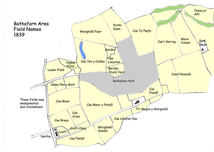
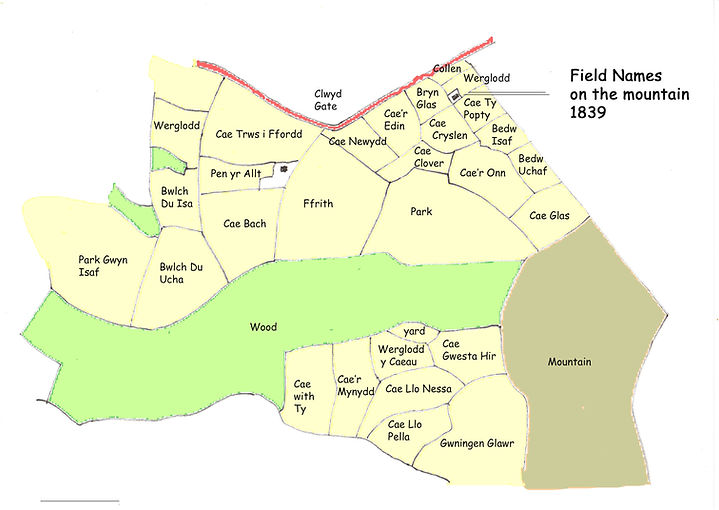
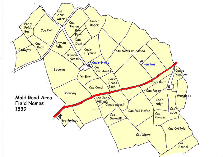
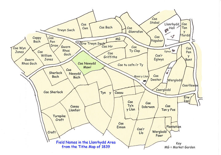
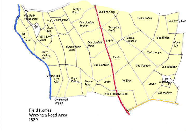
The maps below record the field names in use in 1839. There is much of interest here.


Wrexham Road
Wrexham Road